Karten
Die Liste enthält 30 Einträge. Suchergebnisse löschen und Gesamtbestand anzeigen.
| Abbildung |
Beschreibung Stichwort, Autor, Titel, Buchbeschreibung |
Preis EUR |
|
|---|---|---|---|
| Königlich Preußische Geologische Landesanstalt und Bergakademie (Hrsg.). Erläuterungen zur Geologischen Karte von Preußen und benachbarten Bundesstaaten. Lieferung 107. Blatt Danzig. Gradabteilung 16, no. 38. Berlin, Feister’sche Buchdruckerei, 1903. 4° 78 Seiten; 58 Seiten. Mit 3 Abbildungen. Original Broschur. Gut erhalten, | 24,-- |  |
|
| Leibbrandt, Georg. (Hrsg.) Die Völker der Sowjetunion: Völkerkarte der Sowjetunion (europäischer Teil). Berlin, Otto Stollberg, 1941. | 48,-- |  |
|
| Lodz – Straszewicz, Ludwik. Atlas wojewodztwa lodzkiego. Warszawa, Panstwowe Przedsiebiorstwo Wydawnictw Kartograficznych, 1965. Folio. 24 colored maps. Original brochure. Good condition. | 24,-- |  |
|
| Olmütz Tietze, Dr. E. Geologische Specialkarte. Des geologischen Kartenwerkes NW.-Gruppe Nr. 54. Zone 7 col. XVI. Olmütz. In topograph. Hinsicht bis zum Jahre 1892 evidentgestellt. 1890. Folio. Faltbare Karte. Auf Leinen aufgezogen. | 20,-- |  |
|
 |
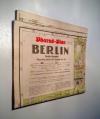
Pharus-Plan, Berlin, große Ausgabe. Pharus-Plan, Berlin N 54. Schwedter Str. 263. Berlin, Pharus-Verlag. 1937. Gefaltet auf 8° / Oktav. Papier altersbedingt leicht gebräunt, sonst sehr guter Zustand mit nur leichten Gebrauchspuren. | 48,-- |  |
| Ravensteins Deutsche Kriegskarten Ost-Frankreich mit Beikarte Paris Frankfurt a.M. Ravenstein, um 1914/15. 1 Blatt. Auf Leinen aufgezogene, gefaltete, lithographierte Karte. Mit Knickspuren | 24,-- |  |
|
 |
Sanson, Nicolas. Atlas Portatif et Nouveau du Voyageur pour l’Italie, avec la Description Geographique & une Table pour trouver facilement les Villes, & c. Amsterdam, Mortier, about 1700. Octav. 56 pages; 16 pages index. With 12 maps. (10 detailled maps and 2 overview maps), all with contemporary coloured frontier lines and an engraved mileage scale. Contemporary marbled cardboard. A bit waterstained. The spine has been restored professionally. Private stamp on title, otherwise fine and complete. | 580,-- |  |
| Schmidt, P.W. Die Sprachfamilien und Sprachenkreise der Erde. Atlas von 14 Karten. Heidelberg, Carl Winters Universitätsbuchhandlung, 1926. Folio. 14 Blatt. Farbig illustriert. Original Halbleinenband. Einband fleckig, sonst guter Zustand. | 30,-- |  |
|
 |
Tardieu, P.F. Carte generale de l’empire de Russie 1787. (General map of Russia). Paris, Maradan, 1787. 56 x 117,5 cm Two sheets joined together, several times folded. No binding. Partly worn at the margins, partly stronger bended, but still an impressive large format map. | 480,-- |  |
| Übersichts Skizze für die Brigade- und Divisionsmanöver der 27. Division sowie Korpsmanöver. | 30,-- |  |
|
|
Einträge 21–30 von 30
Zurück · Vor
|
|||
